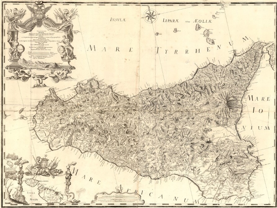
C4: Nova et Accuracy Siciliae by Samuel Schmettau (1721)
Nova et accurate Siciliae Regionum, Urbium, Castellorum, Pagorum Montium, Sylvarum, Planitierum, Viarum Situum ac Singularium quorumque locorum et rerum ad Geographiam Partinentium Descriptio Universalis - 1721 by Samuel von Schmettau - (Cod. C4)
Map of the OldmapsOnline project (Klokan Technologies GmbH, Switzerland and The Great Britain Historical GIS Project c / o University of Portsmouth, UK)
Cartography published online within the project: Ancient Walks and Itineraries of Sicily Zoom in on the map or put it to full screen using the mouse or the control panel below.
Overview of the map