

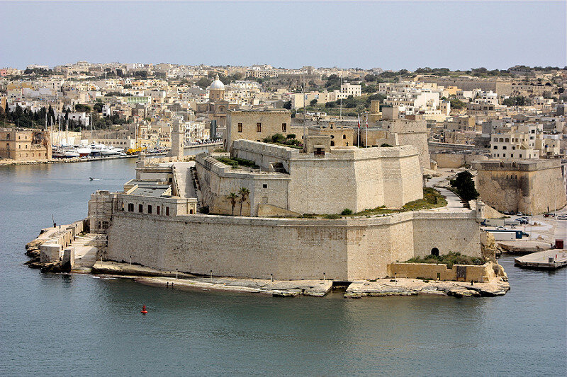
Fort St. Angelo

Source: web
The date of its original construction is unknown. According to the tradition, it dates back to Roman times.
When the Knights arrived on the island in 1530, the fort became the seat of the Order's Grand Master. The fort played a leading role in the Great Siege of 1565, when, against all odds, a formidable army of Saracens was defeated and repulsed. The epic resistance of the Knights during the three months of the siege gave the fort its legendary status. In the 1933th century, the British conquered the fort and first gave it the name of Forte Egmont and then in XNUMX, as Forte Sant'Angelo.
Well entered in the register: National Inventory of Cultural Heritage of the Maltese Islands - National Inventory of Cultural Property of the Maltese Islands (NICPMI)
01479 Forti Sant Anġlu / Fort St Angelo
01480 Bastjun ta 'D'Homedes - D' Homedes Bastion - Fort St Angelo
01481 Cavalier - Fort St Angelo
01482 Curtain wall adjoining D'Homedes Bastion - Fort St Angelo
01483 Main Gateway - Fort St Angelo
01484 Rampart adjoining D'Homedes bastion and overlooking Moat - Fort St Angelo
01485 Main enciente along No 2 battery - Fort St Angelo
01486 Sea-level (no1) battery - Fort St Angelo
01487 No. 2. Battery - Fort St Angelo
01488 No. 3 Battery - Fort St Angelo
01489 No. 4 Battery - Fort St Angelo
01490 Castral enclosure - Fort St Angelo
01491 Barbican - Fort St Angelo
01492 Batterija ta 'De Guiral / De Guiral Battery - Fort St Angelo
01493 Gunpowder Magazine - Fort St Angelo
01494 Sea-filled Moat - Fort St Angelo
01495 Entrance ramp - Fort St Angelo
Look at the card "The Maltese Fortifications"
Card insertion: Ignatius Caloggero
Photo: web
Information contributions: Ignazio Caloggero, Region of Sicily, web
Note: The populating of the files of the Heritage database proceeds in incremental phases: cataloging, georeferencing, insertion of information and images. The cultural property in question has been cataloged, georeferenced and the first information entered. In order to enrich the information content, further contributions are welcome, if you wish you can contribute through our area "Your Contributions"
