

Rocchicella (Palike)
Street View (if present)
Description
Rocchicella (Palike)
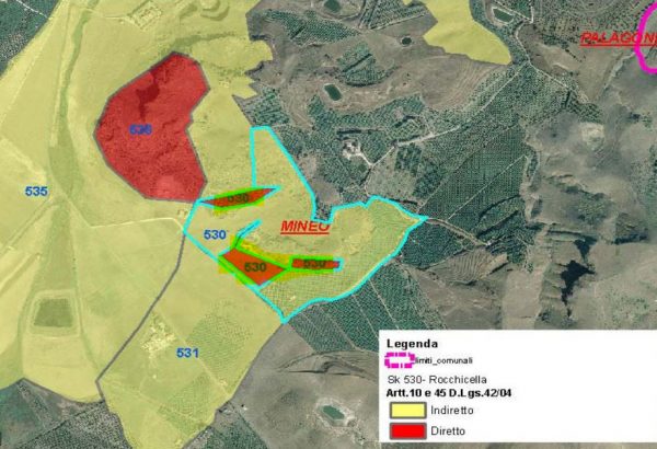
Contrada Rocchicella area (remains of a prehistoric settlement from the Neolithic age - part.91 - ancient bronze age artificial cave tombs_ part.91-47) (Sheet 530)
Templar structures VII-VI century. BC, including road, houses and walls (File 535)
Bibliography:
P. Pelegatti (Palikè, Santuario dei Palici - Bulletin of art ser.5; LI1966, 106-107); Luigi Bernabò Brea (Palikè - Paleolithic site and Neolithic and Eeneo-Kokalos 1965, 23-46) Tommaso Fazello - Palikè (De Rebus Siculis I, 3,2) - Paolo Orsi - Fram
site subjected to archaeological constraints.
Source:
- file 530 Landscape Plan of the Sicily Region - Archaeological areas cards
- http://www.sitr.regione.sicilia.it/geoviewer/
- Guidelines of the regional landscape plan
- http://www.sitr.regione.sicilia.it/geoviewer/
In-depth documents:
PRESS: Well cataloged but partially geolocated. We invite you to provide your contribution by providing us with useful information that allows us to geolocate the cataloged property in detail. See also "Cultural Heritage to be Geolocated"
Card insertion: Ignatius Caloggero
Information contributions: Ignazio Caloggero, Web
Note: The populating of the files of the Heritage database proceeds in incremental phases: cataloging, georeferencing, insertion of information and images. The cultural property in question has been cataloged, georeferenced and the first information entered. In order to enrich the information content, further contributions are welcome, if you wish you can contribute through our area "Your Contributions"
Send a notice to the publisher
[contact-form-7 id="18385"]