

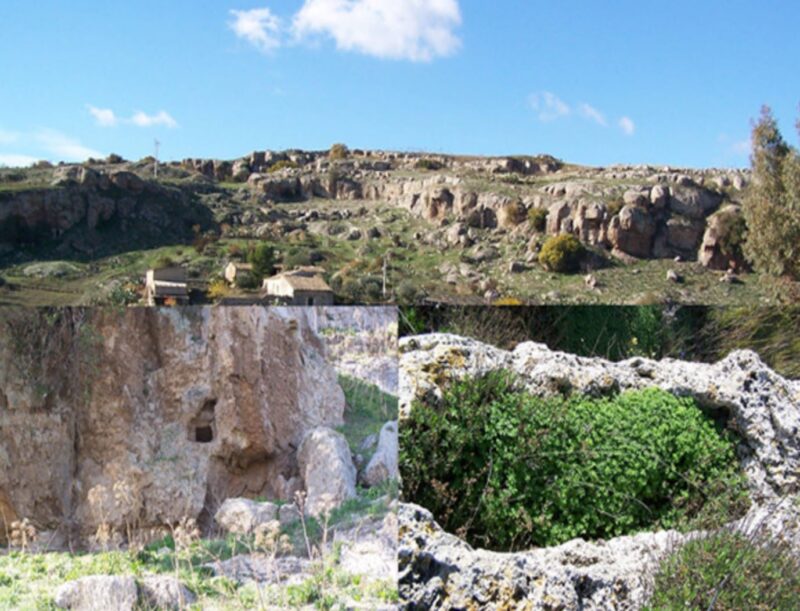
Necropolis in Contrada La Catena
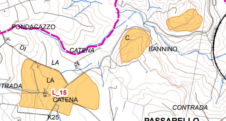
The site of C / da La Catena extends both to the right and to the left of the SS 123. The ridge of the Rocca Benedetto, located immediately to the right of the road, has four cave tombs on the southern side, pseudorectangular in shape and of small proportions. Along the slopes
of the southern ridge and on the top, planted with almond trees, there are some fragments of probable Castelluccian age. More than 100 meters ahead. approximately at Km 25, V, on the left side of the road and upstream of the Case Bannino, the rocky ridge, on the east side, has five cave tombs, some of which are perfectly rectangular and with a slightly recessed opening with respect to the surface of the rocky wall, of small proportions. All around and especially on the west side, in a land excavated over the years due to agricultural work, there are abundant ceramic fragments, some of which are decorated with brown bands on a reddish or yellowish background, probably from the Castellucian age Bronze - XNUMXnd-XNUMXth century . B.C
Area of archaeological interest, art. 142 letter m) (Source text of survey form n. 340 Landscape Plan of the Province of Agrigento - Archaeological Heritage)
Archaeological Heritage Sheets Landscape Plan of Agrigento
Card insertion: Ignazio Caloggero
Photo: card cited
Information contributions: Ignazio Caloggero Web,
Note: The populating of the files of the Heritage database proceeds in incremental phases: cataloging, georeferencing, insertion of information and images. The cultural property in question has been cataloged, georeferenced and the first information entered. In order to enrich the information content, further contributions are welcome, if you wish you can contribute through our area "Your Contributions"
