

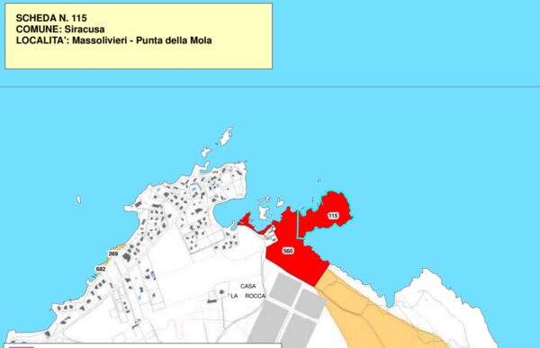
Massolivieri – Punta della Mola
Settlements – Imperial Roman era
On the coastline there are numerous lime kilns from the Roman-Imperial era.
Archaeological restriction pursuant to art.10 Legislative Decree. 42/04 (direct obligation – Declaration of 22/12/1970
(Source text of survey form n.115 Landscape Plan of the Province of Syracuse - Archaeological Heritage)
Archaeological Heritage Sheets Landscape Plan of Syracuse
Card insertion: Ignazio Caloggero
Photo Wikipedia - Author Davide Mauro
Information contributions: Ignazio Caloggero Web,
Note: The populating of the files of the Heritage database proceeds in incremental phases: cataloging, georeferencing, insertion of information and images. The cultural property in question has been cataloged, georeferenced and the first information entered. In order to enrich the information content, further contributions are welcome, if you wish you can contribute through our area "Your Contributions"
