

Frandanisi
Late ancient necropolis.
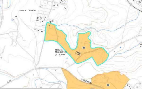
On the top of a hill between Frandanisi di Sotto and Frandanisi di Sopra, a late ancient necropolis has been reported, consisting of around thirty pit tombs dug into the rock, violated in ancient times. They must all refer to a small settlement that arose nearby, traces of which have not yet been identified.
Rocky hill 95 m above sea level
Area of archaeological interest, art. 142 letter m) Legislative Decree 42/04
Bibliographic sources:
Mentesana M., Storicoarchaeological Dissertations, “Historical News of Augsburg”, 7, pp. 7-44; Lanteri R., Augusta and its territory. Elements for an archaeological map
(Text source: survey form no.39 Landscape Plan of the Province of Syracuse - Archaeological Heritage)
Archaeological Heritage Sheets Landscape Plan of Syracuse
Card insertion: Ignazio Caloggero
Information contributions: Ignazio Caloggero Web,
Note: The populating of the files of the Heritage database proceeds in incremental phases: cataloging, georeferencing, insertion of information and images. The cultural property in question has been cataloged, georeferenced and the first information entered. In order to enrich the information content, further contributions are welcome, if you wish you can contribute through our area "Your Contributions"
