

Chief Lander of the Turks
Traces of surface Latomies; grotto.
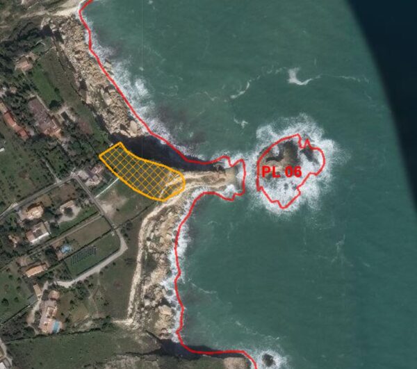
On the top part of the promontory, cuts in the limestone bank have been identified as probable remains of ancient Latomie. Along the northern coast there are natural inlets
probably used since prehistoric times.
The name of the promontory derives from popular tradition and according to which the landing of the Turkish army led by Sinan Bassà took place in 1551.
Bibliographic sources
Lanteri R., Augusta and its territory, elements for an archaeological map, 1997, p.55
Area of archaeological interest, art. 142 letter m) Legislative Decree 42/04
(Source: survey form text no. 694 Landscape Plan of the Province of Syracuse – Archaeological Heritage)
Archaeological Heritage Sheets Landscape Plan of Syracuse
Card insertion: Ignazio Caloggero
Information contributions: Web, Region of Sicily
Photo: Card shown above
Note: The population of the cards of the Heritage database proceeds in incremental phases: cataloging, georeferencing, insertion of information and images. The cultural property in question has been cataloged, and the first information has been entered. In order to enrich the information content, further contributions are welcome, if you wish you can contribute through our area "Your Contributions"
