

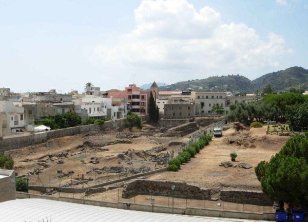
Contrada Diana
The largest and widest strip, in the former land owned by the bishop (between the streets of Conciliazione to the N and G. Marconi to the South: long stretch of the imposing fortification of the fourth century BC and the so-called "Aggere di Sesto Pompeo" of the second half of the XNUMXst century BC; inside the walls, and beyond a ring road, part of a residential area of the XNUMXnd and XNUMXrd century AD, and phases of late antiquity; outside the walls, sepulchral monuments and enclosures funeral homes of the IIIII century AD Text source: UNESCO Management Plan of the Aeolian Islands
Bibliography and in-depth documents:
UNESCO Management Plan of the Aeolian Islands
100) FIRST SICILY - AT THE ORIGINS OF SICILIAN SOCIETY - volume first edited by Sebastiano Tusa Palermo 1997.
235) Meligunìs - Lipàra Vol. I: The prehistoric station of the Diana district and the protohistoric necropolis of Lipari - By Luigi Bernabò Brea and Madeleine Cavalier - Publications of the Aeolian Museum of Lipari - Flaccovio publisher, Palermo 1960
236) Meligunìs - Lipàra Vol. II: The Greek and Roman necropolis in the Diana district - By Luigi Bernabò Brea and Madeleine Cavalier - Publications of the Aeolian Museum of Lipari - Flaccovio publisher. Palermo 1965
237) Meligunìs - Lipàra Vol. III: Prehistoric stations of the Panarea, Salina and Stromboli islands - By Luigi Bernabò Brea and Madeleine Cavalier - Publications of the Aeolian Museum of Lipari - Flaccovio publisher. Palermo 1968
Ignazio Caloggero: History of Sicily Interpreted Vol. 1: Before the Greeks (2022)
Card insertion: Ignazio Caloggero
Information contributions: Ignazio Caloggero Web,
Photos: UNESCO Management Plan of the Aeolian Islands
