

Archaeological site in Xirumi - Lavaggi
Name
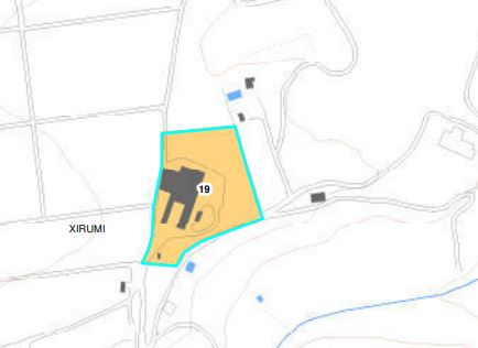
Settlement and necropolis of the late ancient age. (A2.2).
Description
Inside a fence wall, near the stables of the Lavaggi farm, a necropolis was identified consisting of about fifty pit tombs dug into the rock, violated in ancient times, whose closing slabs were used in the construction of stone walls. dry. Ceramic fragments, mostly achromatic, ceramic fragments of light sealed terra, millstones in lava stone and a few tiles with molded edges were recovered in the surrounding land. There are also reports of three or four silos dug into the rock. These evidences, as well as the large square blocks reused in the dry walls of the stables, the larger masseria and a smaller farm to the north, have been interpreted as clues to a rural settlement of late antiquity. Still near the Lavaggi farm, traces of another late ancient necropolis have been identified
Historical information:
The presence of archaeological remains in the Piano Camera-Xirumi area had already been reported at the end of the eighteenth century by Zuppello Santangelo, who remembered in the "predio la Camera" the land known as the Anticaglia where there were "various square stones and some brick burials"
Bibliographic sources
Zuppello Santangelo F., Historical memories of the city of Augusta (late 1997th century - early 42th century, unpublished ms., Augusta Municipal Library, Blasco collection); Lanteri R., Augusta and its territory, elements for an archaeological map, 43, pp. XNUMX-XNUMX
Area of archaeological interest, art. 142 letter m) Legislative Decree 42/04
(Source text of survey form n.19 Landscape Plan of the Province of Syracuse - Archaeological Heritage)
PRESS: Well cataloged but partially geolocated. We invite you to provide your contribution by providing us with useful information that will allow us to geo-locate the listed asset. See also "Cultural Heritage to be Geolocated"
Archaeological Heritage Sheets Landscape Plan of Syracuse
Card insertion: Ignazio Caloggero
Information contributions: Web, Region of Sicily
Photo: Card shown above
Note: The population of the cards of the Heritage database proceeds in incremental phases: cataloging, georeferencing, insertion of information and images. The cultural property in question has been cataloged, and the first information has been entered. In order to enrich the information content, further contributions are welcome, if you wish you can contribute through our area "Your Contributions"
