

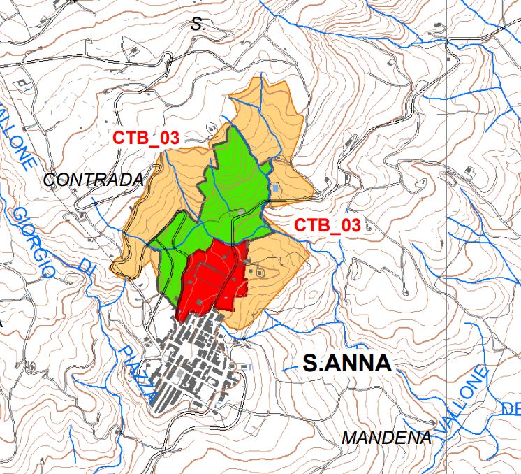
Archaeological site of Sant'Anna / Montevergine
Close to the modern built-up area of the hamlet of S. Anna, we note the presence of a sector of inhabited area from the Imperial Roman age, extended on the slopes of a hill. The archaeological excavations of the eighties of the last century have returned the remains of two residential complexes respectively attributable to the IV - V century. AD and the V-VI century. AD The first includes a series of rooms oriented in the EW direction and underwent in the first half of the fifth century. AD a violent destruction; on its remains the second system was set up with rooms oriented NE-SW. The site, after four centuries of neglect, will become the site of a medieval settlement.
Late Antique / Medieval Roman Age - IV-VI century. AD / XI-XIII AD
Area of Archaeological Interest art. 142 lett. m) Legislative Decree 42/04
(Source text of survey form n.87 Landscape Plan of the Province of Agrigento - Archaeological Heritage)
Archaeological Heritage Sheets Landscape Plan of Agrigento
PRESS: Well cataloged but not geolocated. We invite you to provide your contribution by providing us with useful information that will allow us to geolocate the listed asset. See also "Cultural Heritage to be Geolocated"
Card insertion: Ignazio Caloggero
Information contributions: Web, Region of Sicily
Photo: card cited
Note: The population of the cards of the Heritage database proceeds in incremental phases: cataloging, georeferencing, insertion of information and images. The cultural property in question has been cataloged, and the first information has been entered. In order to enrich the information content, further contributions are welcome, if you wish you can contribute through our area "Your Contributions"
