


Archaeological and Landscape Park of the Valley of the Temples
Unesco site Valley of the Temples
Year of inclusion in the World Heritage List: 1997
Short description of the site
The Greek colony founded in the sixth century BC has become one of the main cities of the Mediterranean basin. The remains of the magnificent Doric temples that dominate the ancient city, a part of which is still buried and intact under modern fields and orchards, testify to its supremacy and pride. A series of careful excavations in the area have shed light on the Hellenistic and Roman city and the burial practices of the early Christian inhabitants
The criteria adopted by Unesco for the inscription of the site in the World Heritage Site:
The Committee decided to enter the area on the basis of criteria (i) (ii) (iii) (iv) considering that Agrigento was one of the largest cities in the Mediterranean area, and has been preserved intact in exceptional conditions. The Doric temple complex is one of the main examples of Greek art and culture.
Useful information:
Location: Agrigento (AG) - Sicily N371723 E133536
Unesco web page: Access the Unesco area
Site area: 934 hectares
Buffer zone: 1869 hectares
Unesco Site Management Plan: Access the Management Plan
Area map recognized by Unesco pdf 12,5 Mb)
Valley of the Temples

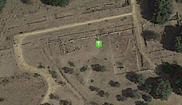
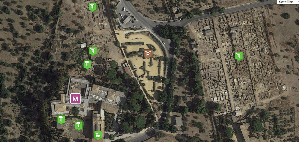
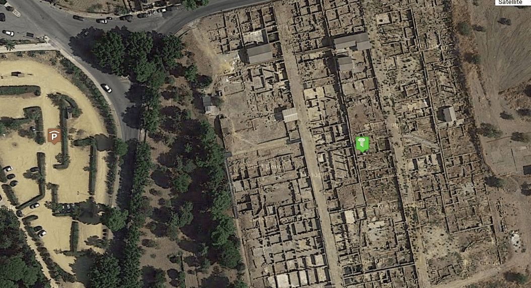
We have catalogued, geocoded and described 34 monuments of the Valley of the Temples and surrounding areas, dividing them into 6 groups. based on their geographic location.
First Group: Temple of Vulcan
Temple of Vulcan ![]()
 Via Vulcano. The Temple is located at the western end of the Valley of the Temples. The Temple of Vulcan dates back to the 34th century BC, of the ancient and imposing structure, which included XNUMX columns, very little remains. In its foundations the remains of an archaic temple were found, of which some parts of the roof decoration are preserved.
Second Group: Area of the Sanctuary of the Chthonic divinities
Kolymbetra garden
 The Kolymbetra Garden, of great archaeological and naturalistic importance, has come back to light after decades of neglect. The origins of this garden date back to the era of Greek colonization. Diodorus Siculus narrates that the tyrant Terone entrusted the architect Feace with the task of designing a water system to supply the city. Part of this system ended at the foot of the city, in a large basin called Kolymbetra. Currently the Garden, which has an extension of 5 hectares, has been entrusted to the FAI, which has carried out the restoration of the vegetation, allowing the identification of hypogea within the garden. The garden has many species of the Mediterranean scrub: myrtle, mastic, terebinth, phillyrea, euphorbia, broom. In the flat part you can visit a farm with lemons, mandarins and oranges of ancient varieties, irrigated according to the techniques of the Arab tradition.
Sanctuary of the chthonic divinities
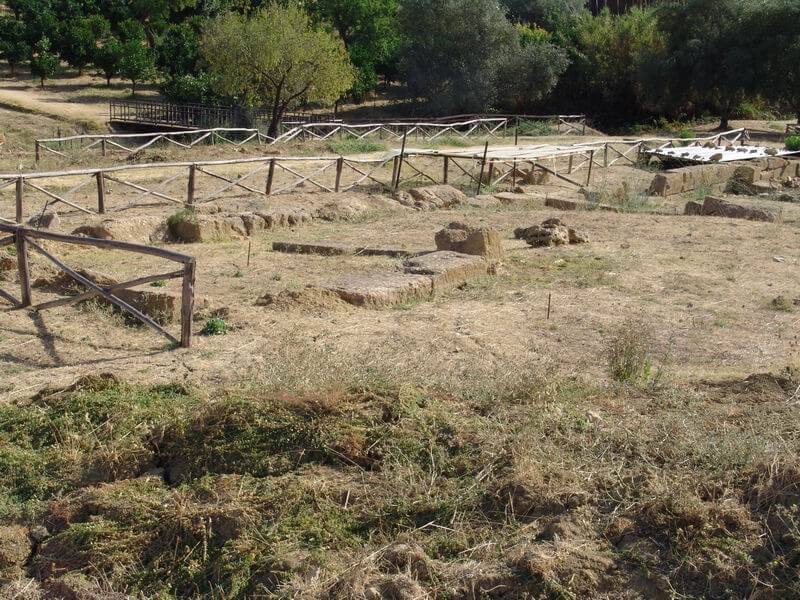
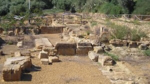
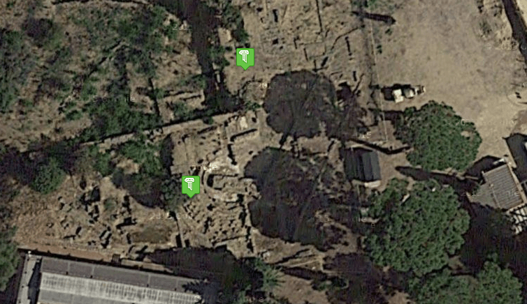
It is a complex of sacred buildings dedicated to the cult of the Chthonic divinities Demeter and Kore dating back to the XNUMXth century BC. The term “Chthonic divinity” refers to divinities, generally female, linked to the cults of underground gods. The sanctuary is characterized by the presence of open-air enclosures with multiple temples inside.
Temple of Castor and Pollux - Dioscuri ![]()

 Temple of the Dioscuri or temple of Castor and Pollux. In reality the temple is located inside the sanctuary of the chthonic divinities and it is therefore probable that it was built in honor of the divinities of the earth (Demeter and Kore) and not of the Dioscuri.
Gate V
South of the Sanctuary of the Chthonic Divinities. It is one of the nine gates that made up the walls that surrounded the ancient Akragas. The walls, 12 km long, were built towards the end of the sixth century. BC and included nine gates: Gate I and II to the East; Gate III, IV and V to the South; Gate VI, VII, VIII, IX to the west. In the concomitant areas the remains of the city walls are visible.

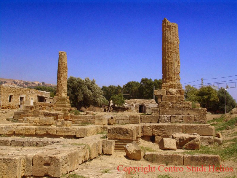
Temple of Jupiter 

 East of the parking lot of the information point and the ticket office of the archaeological park. A pile of ruins now remains of what it would have been, if its construction had been completed, one of the greatest temples built by the Greeks. Its construction, according to Diodorus Siculus, was begun after the battle of Imera, around 480 BC. Its base measures 113,45 meters x 56,30 meters. The columns were about 18 meters high and, about 11 meters high, there were giants, called Telamons or Atlantes, which gave the impression of bearing the entire weight of the architrave just as Atlas had been condemned by Zeus to bear the world for helping the Titans. Today few ruins of this temple remain. Some of the blocks of the temple were used, at the time of Charles III of Bourbon, to build the pier of the port of Porto Empedocle

Lower Agora
 North of the parking lot of the information point and the ticket office of the archaeological park. The Roman Agora with the same functions as the upper Agora located north of the Gymnasium.
High School preparation
 Not far from the lower Agora. The Hellenistic structure, but completely renovated in Roman times, has been identified as the headquarters of the Gymnasium, the place where young people trained for athletic competitions but also used as a place for meeting and education. The identification with the "Gymnasium" is probably due to the discovery, in the place, of a portion of the seat engraved with a dedication to Hermes and Heracles
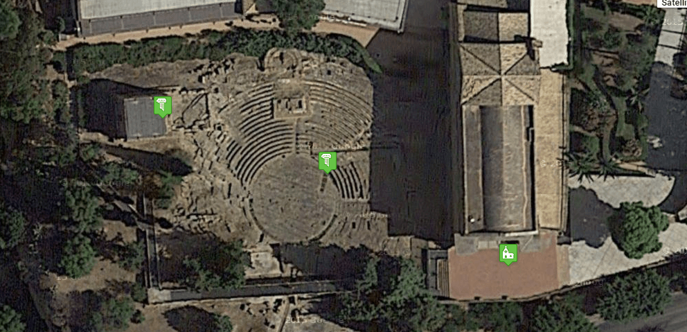
Third Group: Area of the Archaeological Museum of San Nicola
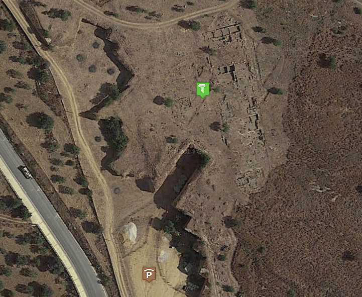
Bouleuterion
 North of the car park of the San Nicola Museum. The Bouleuterion (Room where the assembly of the Council of the elect to legislate took place) has a semicircular cavea inside a quadrangular perimeter wall. The oldest part dates back to the Greek period (V - III century BC), the most recent part dates back to the Roman period, where the structure probably changes its function into a building linked to recreational events. The Roman part has a mosaic floor,
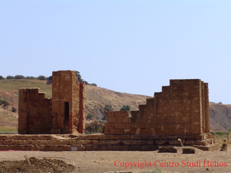
Temple of Isis
East of the car park of the San Nicola Museum. The temple attributed and attributed to the cult of Isis (Italy by the mercenaries of the Roman army on their return from the Egyptian campaign. The structure (60nd century AD) is made up of a triportico delimiting a 36m x XNUMXm square. preceded by a pronaos, and followed by a forepart on a podium, accessible via two lateral flights of nine steps.
His cult spread in the Greco-Roman world probably around the III, II century. B.C. and was associated with that of Demeter. THE
Upper Agora
West of the car park of the Museum of San Nicola, near the Bouleuterion. It is the Agora of the Greek era, the square where the market was held and the citizens gathered in assembly
Oratory of Falaride
 A few meters south of the Archaeological Museum of San Nicola. The Oratory of Falaride is a small Roman temple transformed into an oratory in medieval times following the construction of the nearby church of San Nicola.
Ekklesiasterion
Adjacent to the Oratory of Falaride. The Ekklesiasterion (assembly), is the point where the citizens with the right to vote gathered in the assembly to pass the laws concerning the politics of the polis. The structure dates back to the 3000th - XNUMXrd century BC. In Roman times it continued to have the same function and was called "comitium". The semicircle-shaped structure with prolonged ends could accommodate about XNUMX citizens.
Archaeological Museum of San Nicola
The Museum is located in Contrada Fontanelle in the northern part of the Valley of the Temples, occupies part of the premises of the Monastery annexed to the adjacent church of San Nicola.
The Regional Archaeological Museum of Agrigento collects archaeological material that is part of state, civic and diocesan collections.
The museum comprises two autonomous sections. The first section "The ancient city of Agrigento and its suburban territory" consists of 11 rooms: room 1 topography of the city (documents) room 2 the prehistoric and indigenous phase room 3 vascular collections room 4 architectural sculptures room 5 the sanctuaries of the areas sacre Agrigento room 6 documentation of the temple of Olympian Zeus and recomposition of the figure of Telamon room 7 the city from the archaic Greek age to the Roman imperial age room 8 epigraphs room 9 medals room 10 finds from civil public buildings of the Greek and Roman age room 11 the Greek necropolis of Agrigento. The second section consists of a single room "The sites of the territory of the provinces of Agrigento and Caltanissetta, from prehistory to the Hellenization phase"
Church of St. Nicholas
 The Church is located in Contrada Fontanelle in the northern part of the Valley of the Temples. The Norman-Gothic style church was built in in the 1531th century by Cistercian monks. The façade has a pointed portal and wooden doors from 1592. The interior, with a single nave, preserves various works including: a marble sarcophagus showing the legend of Phaedra and Hippolytus; a marble statue representing the Madonna and Child from the Gagini school (XNUMXth century AD); a wooden crucifix described in the story of Pirandello the Lord of the ship and a painting from XNUMX depicting St. Diego. The monastery attached to the church is now occupied by the Regional Archaeological Museum of Agrigento.
Hellenistic-Roman quarter
 The Hellenistic-Roman quarter, frequented until the 15.000th century AD, has an extension of 20 square meters. The neighborhood is home to the remains of over XNUMX houses. The first houses date back to the Greek period (VI-V century BC) while the last ones are from the Roman period (III-IV century AD). The houses have been given a name based on the shapes, the frescoes and the objects found, some of these: Casa delle Afroditi; House of the Mosaic of the four seasons; House of the Peristyle; Casa del Maestro abstractionist (presents an abstract mosaic); Casa del Portico; Terracotta atrium house (due to the presence of a floor with red terracotta bricks); Two-story house; House of the Swastikas (due to the presence of unconate crosses inside), Casa della Gazella; House of the Dionysus and House of the Athlete
Fourth Group: Area of the Archaeological Park
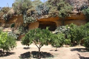
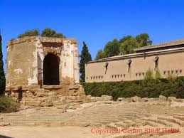
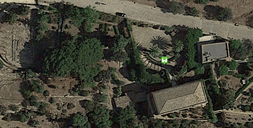
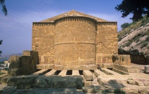
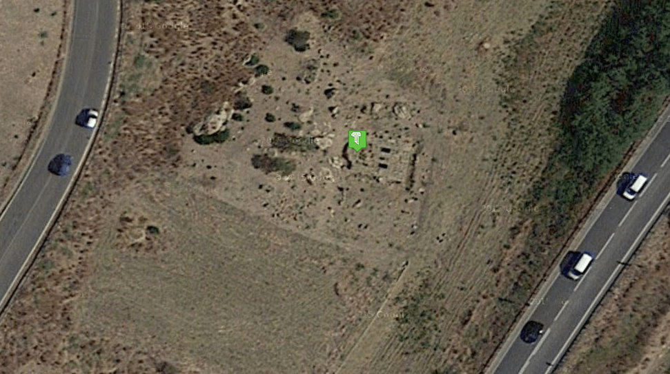
Tomb of Theron ![]()
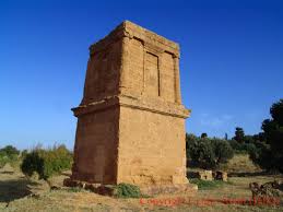 At the corner of Via Giuseppe La Loggia and the Provincial Road 4 in the direction of the Park of the Valley of the Temples. The building is referred to as the Tomb of Theron, tyrant of Akragas from 488 BC to 472 BC. In reality it would be a mausoleum built in Roman times. The shape recalls the African mausoleums, cubic in shape, of the ancient structure remain two floors
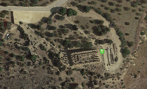
Temple of Hercules
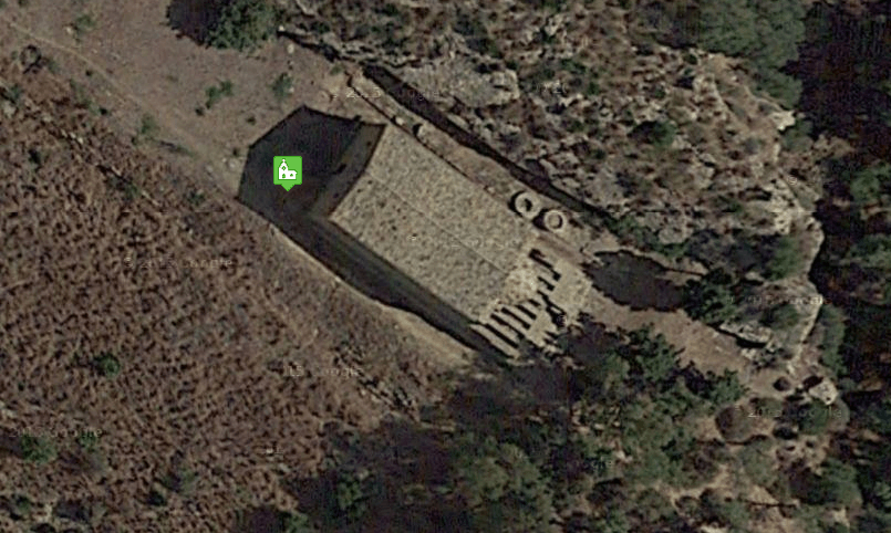
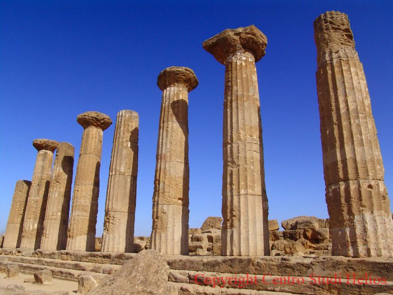 To the west of the parking lot of the information point and the ticket office of the archaeological park, it is the first of the monuments that you encounter when climbing the Via Sacra that leads to the Temple of Concordia. It is considered the oldest temple among the Agrigento temples. Presumably dating back to the 1920th century BC. C. Cicero speaks of it describing it as very close to the agora. The temple was destroyed, like many others, due to an earthquake and only around XNUMX the eight columns that make up the currently visible structure were raised.

Villa Aurea and Porta IV
 The Villa takes its name from the fact that nearby, in the direction of the Temple of Hercules, there was Porta IV which, being the most important gateway to the ancient city, was also called Porta Aurea. The villa is a late 800th century construction, lived there by the English Alexander Hardcastle, from 1925 to 1932. who financed the reconstruction of the eight columns of the Temple of Heracles (Hercules). Under the villa and in its garden there are remains of Christian hypogea.
Valley of the Temples: Fragapane Catacombs
 Going up the Via Sacra, to the north east of the Villa Aurea, there is a hypogeic catacomb complex of the XNUMXth XNUMXth century AD. On the sides of this necropolis there is a corridor leading to the catacombs, full of burial chambers (called “Fragapane Grotto”).
Roman Necropolis (Giabertoni)
On the right side of the Via Sacra to the south of the Fraganane catacombs and to the west of the Temple of Concordia there is a vast area of Roman catacombs called the Giambertoni catacombs. The burials are generally referable to the imperial era (I-III century AD), some of them were reused up to (IV-VI century AD).
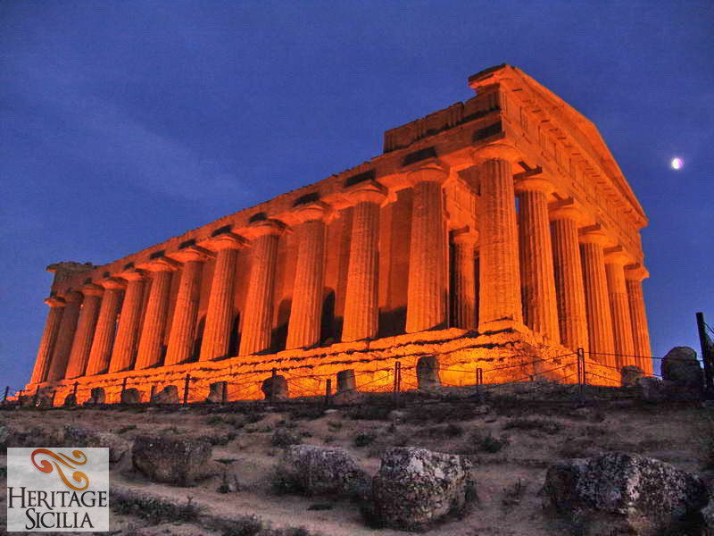
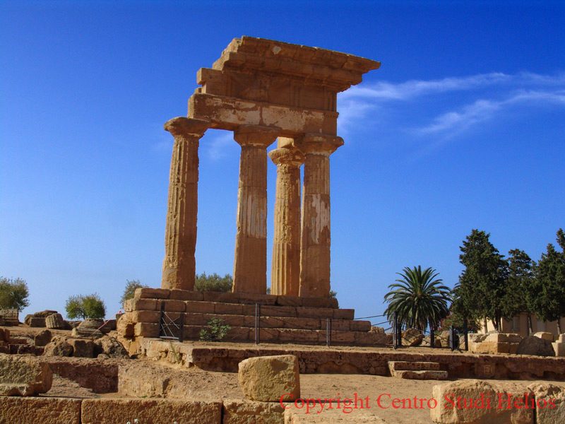
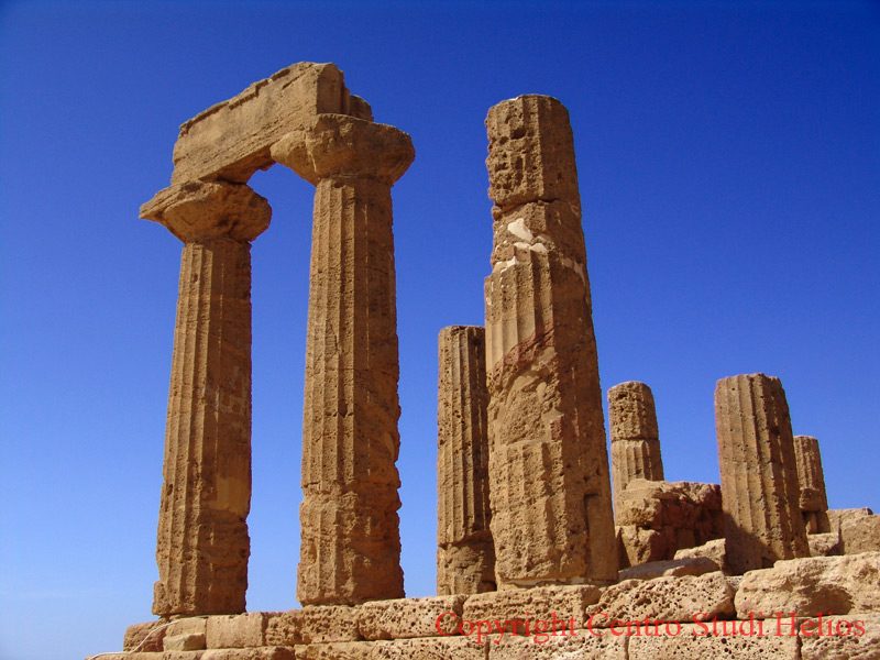
Temple of Concord
 The Temple of Concordia (39,44th century) takes its name from a Latin inscription found near the same temple dedicated to the Concord of the Agrigento. It is the best preserved temple, thanks also to the fact that it was transformed into a Christian temple in the 16,91th century AD On an ample base of four steps which had the task of eliminating the problems caused by the unevenness of the ground (6 × 13 m ), the temple has 78 rows, each with 6,72 columns, for a total of XNUMX columns high m. XNUMX and characterized by twenty grooves, the gables are also in good condition. The cell, preceded by a pronaos, is accessed via a step; well preserved are the pylons with the access stairs to the roof.

Byzantine Arcosoli
 Between the Temple of Concordia and the Temple of Juno, along the remains of the ancient walls, carved into the rock, a series of arcosolium tombs from the Byzantine period are visible
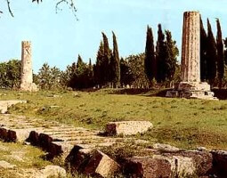
Temple of Juno and Porta III
 It is the last monument to be found along the sacred road of the Valley of the Temples Park. The temple, built around the middle of the 406th century BC, is dedicated to the goddess Era Lacinia (Juno) wife of Zeus. The temple, like that of Corcordia, has six columns in width and thirteen in length. The Temple was set on fire in XNUMX by the Carthaginians. in Oves del Tempio there was Porta III of which today very little remains due to the landslide of part of the rocky ridge and the numerous transformations undergone by the walls in this area.
Fifth Group: Area of the Sanctuary of Demeter and Persephone
Temple of Demeter (Church of San Biagio)
 South-east of the Provincial Botanical Garden, in the locality of San Biagio, from Via Demetra it is possible to take a small road that leads to the Church of San Biagio (30,20th century) which incorporates the remains of the Temple of Demeter (13,30th century BC). The basement (XNUMX × XNUMX m) and part of the external walls of the cell are preserved from the temple. The base is clearly visible behind the church while the remains of the cell of the ancient temple are incorporated into the church itself.
Rock Sanctuary of Demeter and Persephone
From the Terrace of the Temple of Demeter (Church of San Biagio), through a staircase carved into the rock, you reach the underlying sanctuary dedicated to Demeter and Persephone (XNUMXth-XNUMXth century BC). The place is also known by the name of the rock sanctuary of San Biagio. The Sanctuary is completely excavated inside the hill. The structure consists of two caves in natural parts and a third completely artificial cave. It is probable that the place was a seat of worship even before the arrival of the Greeks by the indigenous population.
Gate I
It can be reached from Via Demetra, from the square in front of the cemetery, until you reach the gate of the "Fondo Morello". Next to this, immediately after passing it, there are the remains of Gate I, one of the nine gates that made up the walls that surrounded the ancient Akragas. The walls, 12 km long, were built towards the end of the sixth century. BC and included nine gates: Gate I and II to the East; Gate III, IV and V to the South; Gate VI, VII, VIII, IX to the west. The gate was reached by a road coming from the valley below.
Bulwark in Tenaglia
About a hundred meters west of Porta I, the remains of the defensive structure known as the Baluardo a Tenaglia are visible. It served to protect the city at a point where the conformation of the land was a weak point for the defense of the city. The barrier was made up of two sectors of walls joined at an acute angle, forming a fortification tower at the vertex, on the external side.
Fifth Group: Punic Quarter
Punic district
 South of the Cemetery with practically bordering and North of Gate II. The conformation of the houses is similar to other Punic structures present in Mozia, Lilibeo and Selinunte hence the name of the Punic quarter. Probably the place was the seat of elements coming from the Punic territories coming from western Sicily or from Africa itself.
Gate II (Gela Gate)
South of the "Punico" district. Gate II, one of the nine gates that made up the walls surrounding the ancient Akragas. The walls, 12 km long, were built towards the end of the sixth century. BC and included nine gates: Gate I and II to the East; Gate III, IV and V to the South; Gate VI, VII, VIII, IX to the west. The gate was reached by a road coming from the valley below.
Sixth Group: Other archaeological areas outside the walls
Walloon Christian Basilica of San Biagio
 The small basilica located at the foot of the eastern slope of the Hill of the Temples on Vallone San Biagio, under the Temple of Juno. The small church (9,20 × 6,15 m) was built in the early 2th century AD over a Roman tomb from an earlier period. The front part of the small nave contains XNUMX tombs, it is assumed that they are the tombs of the martyrs Peregrino and Libertino (the latter bishop of the city) during the persecution of Valerian and Gallienus in the mid-third century. AD and that the church was built on their tombs placed in the very place of their sacrifice. Another small tomb, set against the southern wall of the cell, dates back to the XNUMXth century AD
Temple of Aesculapius
 Temple of Asclepius, or temple of Aesculapius, part of an extra-urban sanctuary built far from the city walls, a place of pilgrimage for the sick in search of healing.

Note: with the symbol ![]() the monuments explicitly mentioned in the Unesco Icomos 831 identification document are indicated
the monuments explicitly mentioned in the Unesco Icomos 831 identification document are indicated
"Sicily on the Net" web area connected: Archaeological Area of Agrigento (Valley of the Temples) (1997)

Area recognized by UNESCO (Source Unesco.org)
Download map in pdf: IT-831-item28
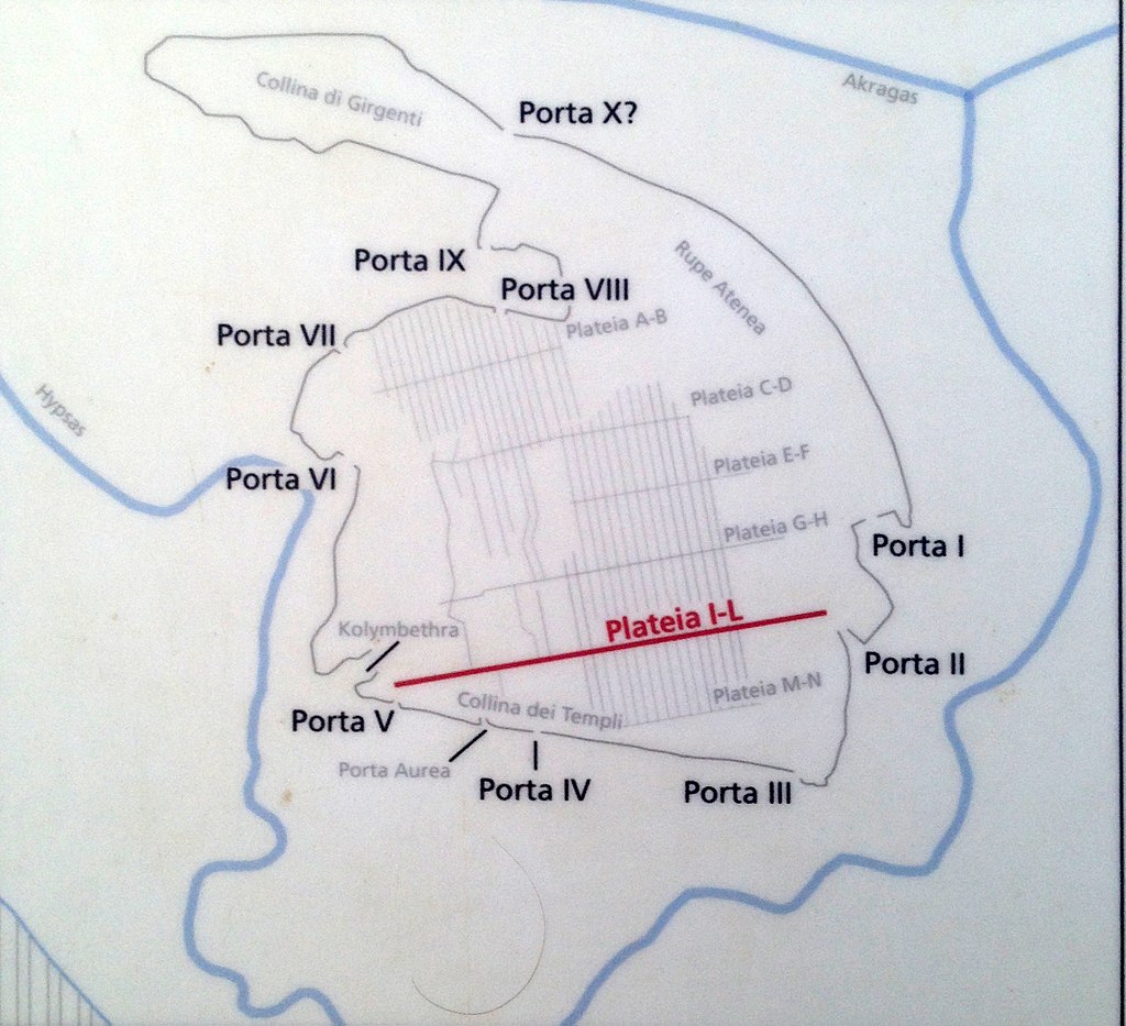
The gates of Agrigento (Source Wikipedia)
Card insertion: Ignazio Caloggero
Information contributions: Ignazio Caloggero Web
Photo: Ignazio, Caloggero
Note: The populating of the files of the Heritage database proceeds in incremental phases: cataloging, georeferencing, insertion of information and images. The cultural property in question has been cataloged, georeferenced and the first information entered. In order to enrich the information content, further contributions are welcome, if you wish you can contribute through our area "Your Contributions"
