

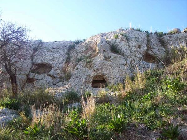
Mount Octavius
Hut village and necropolis (tholos tombs with conical and chamber profiles) from the late Bronze Age (North Pantalica).
In-depth article: http://sicilianamentemontedoro.blogspot.com/p/le-grotte-del-monte-ottavio-montedoro.html
- http://www.sitr.regione.sicilia.it/geoportale/it/
- Guidelines of the regional landscape plan
Card insertion: Ignatius Caloggero
Photo: web http://sicilianamentemontedoro.blogspot.com/p/le-grotte-del-monte-ottavio-montedoro.html
Information contributions: Ignazio Caloggero, Web
Note: The populating of the files of the Heritage database proceeds in incremental phases: cataloging, georeferencing, insertion of information and images. The cultural property in question has been cataloged, georeferenced and the first information entered. In order to enrich the information content, further contributions are welcome, if you wish you can contribute through our area "Your Contributions"
