

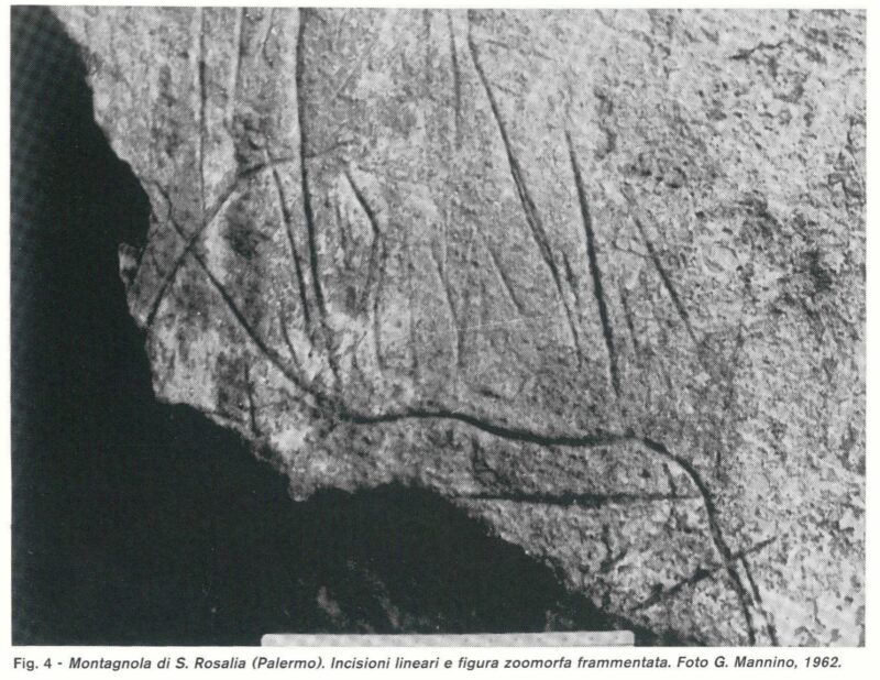
Montagnola di S. Rosalia or S. Elia, caves
Ten caves of archaeological interest from the Palaeolithic and Mesolithic periods with rock art.
In-depth document: Pippo Lo Cascio and Sebastiano Tusa: The Caves of the Mountain of Santa Rosalia in Archaeological Sicily 1995 (December 5):
Sicilia_Archeologica_1995_87-88-89_Dicembre-05
In-depth document: Gianfranco Purpura: Depictions of ships in some caves around Palermo. Extract from the magazine “Sicilia Archeologica” Year XII n. 40 2nd half 1979
download the document:
Depictions of ships in some caves around Palermo
Card insertion: Ignazio Caloggero
Information contributions: Ignazio Caloggero Web
Photo G. Marino from: Pippo Lo Cascio and Sebastiano Tusa: The Caves of the Mountain of Santa Rosalia in Archaeological Sicily
Bibliography and further in-depth documents:
100) FIRST SICILY - AT THE ORIGINS OF SICILIAN SOCIETY - volume first edited by Sebastiano Tusa Palermo 1997.
198) D. Petruso - V. Forgia - L. Sineo: The human population of Sicily: an interdisciplinary review in the Archive for Anthropology and Ethnology - Vol. CXLIV (2014)
Download file: SINEO et al
200) Gioconda La Magna (edited by) Between Etna and Simeto - Archaeological research in Adrano and its territory - Proceedings of the study meeting for the 50th anniversary of the establishment of the Adrano Museum Adrano, 8 June 2005 - Library of the Regional Province of Catania 2009. Download file: The_Neolithic_in_Valle_del_Simeto
Ignazio Caloggero:
History of Sicily - 1.2. Paleolithic and Mesolithic:
History of Sicily - 1.2.1: Religious sentiments and burials in the Paleolithic and Mesolithic
History of Sicily - 1.2.2: Art in the Paleolithic and Mesolithic
History of Sicily - 1.2.3: Archaeological sites of the Sicilian Paleolithic and Mesolithic
PRESS: Well cataloged but not geolocated. We invite you to provide your contribution by providing us with useful information that will allow us to geolocate the listed asset. See also "Cultural Heritage to be Geolocated"
Note: The populating of the files of the Heritage database proceeds in incremental phases: cataloging, georeferencing, insertion of information and images. The cultural property in question has been cataloged, georeferenced and the first information entered. In order to enrich the information content, further contributions are welcome, if you wish you can contribute through our area "Your Contributions"
