

Calafarina cave
From the Copper Age to the Byzantine Age
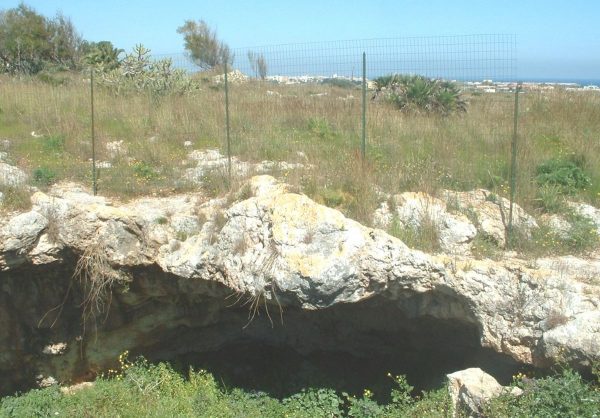
Natural cave open on the rock overlooking the sea consisting of two large rooms connected by a long tunnel. The cave develops in length and on the largest of the rooms there is the opening. It is rich in archaeological sediments
from prehistory to the Byzantine age.
The cave was explored by the Orsi and over time it has undergone raids and rearrangements.
Bibliography:
P. Orsi BPI XXXIII, 1907 p. 7 ss. P. Orsi N. Sc. 1898, p.36 T. Fazello De Rebus Siculis, 1749, t. I, p.218 b Peace, Art and Civilization of Ancient Sicily 1935, v. I, pp. 122 -124 LB Brea, Sicily before the Greeks, 1958, p.73 L. Guzzardi, B. Basile, IL Capo Pachino in antiquity, Taranto 1996 pp. 195-197
Site subject to archaeological restrictions. DM // 1955/06/27; FROM // 1984/04/19 // n.857
(Source text of survey form n.466 Landscape Plan of the Province of Syracuse - Archaeological Heritage)
Archaeological Heritage Sheets Landscape Plan of Syracuse
The cave is also a Sites of Geological Interest: https://www.lasiciliainrete.it/directory-tangibili/listing/grotta-calafarina/
The cave is linked to the Legend of the Treasure of Calafarina
Card insertion: Ignazio Caloggero
Information contributions: Web, Region of Sicily
Photo: wikipedia
Note: The population of the cards of the Heritage database proceeds in incremental phases: cataloging, georeferencing, insertion of information and images. The cultural property in question has been cataloged, and the first information has been entered. In order to enrich the information content, further contributions are welcome, if you wish you can contribute through our area "Your Contributions"
