

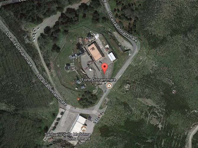
Fort Dinnammare (Fort Umbertino)
LOCATION:
Located inside the Radio Interforze Bridge, next to the homonymous sanctuary dedicated to the Madonna
DATING:
XNUMXth CENTURY
DESCRIPTION:
It was part of the fortification system called Forti Umbertini. It was dissected in 1932 to build the current inter-force barracks used as a nodal transmission center
STRONG UMBERTINES
The Forts called Umbertini are so called because they were built during the reign of Umberto I of Savoy for the defense of the Strait. It is a system of fortifications that is part of a broader plan for the defense of peninsular Italy. Commissioned by the Minister of War Milon at the end of the 7th century. The Royal Decree of 12/1882/1128 n. XNUMX initiated the start of the procedures for the construction of these fortifications. The Umbertini Forts were scarcely used, also because they were not completely suitable for the new forms of attack with the arrival of the planes, still not present as much as the fortifications were conceived and designed. Strong followers fall within the territory of Messica: Mangialupi, Masotto, Monte dei Centri, Campone, Cavalli, Ferraro, Ogliastri, Petrazza, San Jachiddu, Shiaffino, Serra La Croce, Dinnamare, Spuria, Menaja Crispi.
Note: The populating of the files of the Heritage database proceeds in incremental phases: cataloging, georeferencing, insertion of information and images. The cultural property in question has been cataloged, georeferenced and the first information entered. In order to enrich the information content, further contributions are welcome, if you wish you can contribute through our area "Your Contributions"
Find out more on Data bank of the Material Heritage of Sicily
Get to know the Sicilian Cultural Heritage databases: Data Maps Heritage
