


Cave of Cusa

The large area of the Cave di Cusa rises about 13 km north-west of Selinunte, in the territory of Campobello di Mazara, on a plateau near the coast. From these stone quarries the building material destined for the Temples of Selinunte was extracted. The place, even if more than 10 kilometers away from Selinunte, was chosen for the presence of a very compact and massive calcarenite bank, characteristics that allowed to detach elements of such large dimensions as those of the temple C. The pieces, after being almost entirely made, they were detached from their matrix thanks to the jack effect produced by wooden wedges expanded by the effect of water. The quarries were abruptly abandoned with the almost instantaneous interruption of the extraction, processing and transport of the column drums, following the invasion of the Carthaginian army in 409 BC. The pieces were left where they were, some just roughly hewn. Of the drums already extracted, some were ready to be transported away; others, already on their way to Selinunte, were abandoned and can be recognized along the road. In addition to drums of columns, in the quarries it is also possible to recognize some capitals, as well as rectangular engravings to obtain squared blocks, all destined for the temples of Selinunte. The place was visited by Houel as it recalls one of his drawings
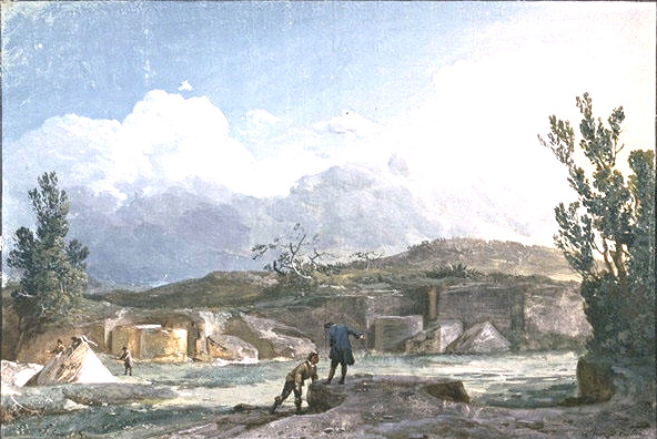
Houel: Cave of Cusa
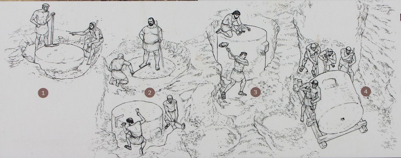
The phases of construction of a column.
- cleaning and subdivision of the portion of rock planned for extraction
- excavation around the rock
- detachment from the rock
- demolition of the drum and placing blocks on sledges or wooden wheels for transport to the construction site
By Davide Mauro - Own work, CC BY-SA 4.0, https://commons.wikimedia.org/w/index.php?curid=55361454
Card insertion: Ignazio Caloggero
Information contributions: Ignazio Caloggero Web,
Note: The populating of the files of the Heritage database proceeds in incremental phases: cataloging, georeferencing, insertion of information and images. The cultural property in question has been cataloged, georeferenced and the first information entered. In order to enrich the information content, further contributions are welcome, if you wish you can contribute through our area "Your Contributions"
