

Sant'Angelo castel
The castle stands on the extreme eastern offshoot of the Licata mountain, 130 meters above sea level and dominates the port to the south, the city and the plant and north. Numerous archaeological remains are preserved all around (necropolis, sanctuaries, silos, roads, monumental tombs, residential areas, cisterns, etc.).
The construction was begun by Hernando Petigno, commander general of the cavalry of the Kingdom of Sicily and Governor of the military square of Syracuse, in 1615 next to a pre-existing watchtower with a quadrangular base built between 1583 and 1585 on a project by the engineer Camillo Camillians. The works were interrupted until 1636, when they were resumed. The direction of the works and the care for the armament was entrusted to Serpione Cottone, Marquis of Altamura. The bastion was completed and inaugurated in 1640 and is a rare example of Baroque fortresses built in Sicily in the XNUMXth century. Century.
The castle never suffered attacks of any kind, demilitarized, it was used as an auction telegraph, for state service, from 1849 to 1856. In the early 900s a "traffic light" was installed there with a garrison of the Air Force, which it continued to function until 1965, when the castle was definitively abandoned. By decree of 8 July 1969, it was declared of particular artistic and historical interest, pursuant to law no. 1 of 1939 June 1089.
In the 80s it was the subject of a restoration intervention by the Superintendency BB.CC.AA. of Agrigento essentially aimed at the recovery of the tower and some rooms that overlook the courtyard, managing to fully recover the architectural organism with the execution of all the works indispensable for its better conservation and allow a complete use of both the internal atrium and of the terraces. Its location in the center of an archaeological area of exceptional interest, that is, in the center of the Hellenistic city that extends on the top of Monte Sant'Angelo, makes it the natural point of reference for visitors to the surrounding archaeological area.
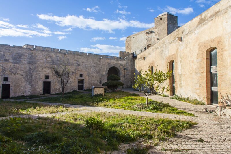
The planimetric layout has an approximately triangular shape, the full volumes of the pre-existing watchtower and the lower rooms wind around a triangular courtyard with a central underground cistern. The architectural complex shows rigid and continuous forms underlined on the outside by the robust compactness of the scarp walls and by the continuous battlements; inside the rooms, different in height, manage to articulate a more varied space, albeit around a planimetrically rigid central core. The very thick and cordoned walls on the outside, at the height of the battlements, join the mighty square tower that is half completely filled.
To the east, west and north there were some watchtowers straddling the corners of the roadside officers on sturdy corbels. The soldiers' quarters, stables and warehouses were built along the entire internal wall perimeter. Access was allowed only from noon, via a drawbridge that ran over a moat, which isolated only the large tower from the countryside. Opposite the entrance, at the end of the courtyard, to the west, under a large archway, stood the chapel of the castle, which no longer exists. Only the signs of the frames remain, which probably included some frescoes or paintings.
(Source: wikipedia)
Card insertion: Ignazio Caloggero
Photo: Di Davide Mauro - Own work, CC BY-SA 4.0, https://commons.wikimedia.org/w/index.php?curid=55543882
Information contributions: Ignazio Caloggero Web,
Note: The populating of the files of the Heritage database proceeds in incremental phases: cataloging, georeferencing, insertion of information and images. The cultural property in question has been cataloged, georeferenced and the first information entered. In order to enrich the information content, further contributions are welcome, if you wish you can contribute through our area "Your Contributions"
