

Wood of Calatafimi
Site type: SAC - Special Conservation Area
Code: ITA010013 - Hectares: 241
Description:
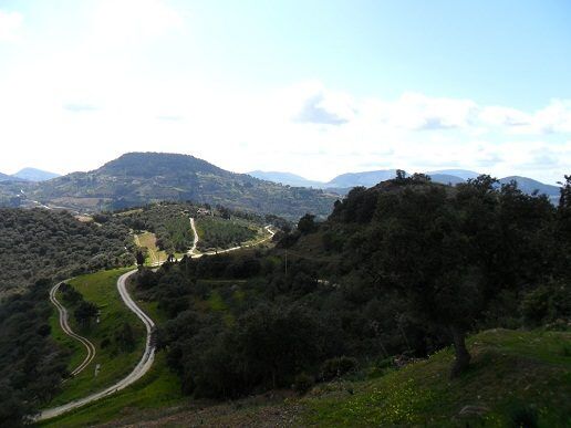
The SIC, extending over an area of about 210 hectares, is located in the territory of the municipality of Calatafimi (TP), where it includes a significant forest core dominated by Quercus suber, which extends between the Contrade Angimbè, Fastuchera and Bosco, between about 200 and 365 meters of altitude. From a geolithological point of view, it is an extensive outcrop of sands and quartzite substrates (Upper Messinian-Tortonian). Following the bioclimatic classification proposed by BRULLO et al. (1996), the territory falls mainly in the lower sub-humid thermo-Mediterranean belt, with an average annual temperature of 16,4 ° C and average annual rainfall of 766 mm. On quartzite substrates the prevailing potential is precisely referred to the series of the Sughera (Genisto aristatae-Querco suberis sigmetum), while in the deeper and more evolved soils it tends towards the series of acidophilic deciduous oak to Virgilian oak (Erico-Querco virgilianae sigmetum). Aspects of riparian vegetation are also represented along the torrential incisions, referring to the orders of Populetalia albae and Salicetalia purpureae.
The aspects of Quercus suber constitute forest nuclei of a certain importance, especially for the sector of the Trapani area, where these formations are quite rare. The woods themselves develop in a territorial context largely occupied by crops, which is why it is a particularly interesting biotope both from a floristic and phytocenotic point of view, but also as an important oasis of refuge for sedentary and migratory fauna.
Source: Ministry of the Environment Natura 2000 form
Ministerial data: Ministerial Map Natura 2000 form
Card insertion: Ignazio Caloggero
Photo: web
Information contributions: Ignazio Caloggero, Region of Sicily
Note: The populating of the files of the Heritage database proceeds in incremental phases: cataloging, georeferencing, insertion of information and images. The cultural property in question has been cataloged, georeferenced and the first information entered. In order to enrich the information content, further contributions are welcome, if you wish you can contribute through our area "Your Contributions"
