

Forests of Gibilmanna and Cefalù
Site type: SAC - Special Conservation Area
Code: ITA020002 - Hectares: 2570
Description:
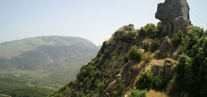
The SIC area, which covers approximately 2489 hectares, falls within the territories of the municipalities of Gratteri, Cefalù and Pollina, as well as being partially included within the Madonie Natural Park. It extends from the sub-coastal strip of the Cefaludese to the hilly areas inland, incorporating the orographic ridges of Pizzo S. Angelo (1081 m) and Cozzo Castellano (927 m). From a geological point of view, it is mainly sandstones and quartzarenites alternating with clays, silty and sandy shales, marls and calcarenites or various shales. Based on the Rivas-Martinez classification, the bioclimatic characteristics of the territory can be summarized in the following types: - thermo-Mediterranean (temperature> 16 ° C) sub-humid (rainfall: 600-700 mm): coastal and sub-coastal area; - mesomediterranean (temperature = 16 -13 ° C) sub-humid (rainfall: 600-1000 mm) and humid (rainfall:> 1000 mm): hilly area. partly natural, settled in contexts dominated mainly by the series of the Sughera (Genisto aristatae-Querco suberis sigmetum). Inland, the series of Holm oak (Aceri campestris-Querco ilicis sigmetum) and Quercia virgiliana (Oleo-Querceto virgilianae sigmetum and Erico-Querco virgilianae sigmetum) are also represented.
The SIC area is rich in wood formations of significant flora-fauna, landscape and environmental interest, characterized by the presence of a high number of monumental trees. Various entities of the vascular flora are also represented, which are very rare in the regional area and are considered to be of significant interest (section 3.3: D).
It falls within the Madonie Park
Ministerial data: Ministerial Map Natura 2000 form
Card insertion: Ignazio Caloggero
Photo: web
Information contributions: Ignazio Caloggero, Region of Sicily
Note: The populating of the files of the Heritage database proceeds in incremental phases: cataloging, georeferencing, insertion of information and images. The cultural property in question has been cataloged, georeferenced and the first information entered. In order to enrich the information content, further contributions are welcome, if you wish you can contribute through our area "Your Contributions"
