


Equipped state-owned area Casale
From Nicosia, follow the signs for Cerami along the SS n. 120 and after about 3 Km. Follow the signs for Contrada Casale on the right. Continue for about 3 km and continue in the direction of the Bonfiglio district along an artery that runs through high-mountain areas characterized by the presence of very unique houses carved into the rock, which are currently inhabited by shepherds.
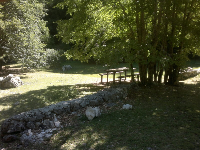
At times you can see strips of an oak wood that has been crossed by the fire and is slowly regaining its space. After about 4 Km. Of winding road, but beautiful because you can breathe the real country air, a large Eucalyptus appears in front of us. Take the forest road that runs along it and after about 1 km we will arrive at the Casale area, the destination of our journey. A refurbished forest block is the only building in the area that can be considered as a base for groups of hikers and various excursionists. The area currently does not consist of fixed structures such as benches and tables, but if necessary, those provided by the forestry house are used and placed nearby. Very interesting to see is the experimental cultivation of wood walnut, chestnut and some varieties of cherry. The panoramic position of this area allows you to see wide views of this part of the Sicilian hinterland and around the Forest House a wildlife area has been created with the presence of deer, which are the joy for the many young visitors who come from all the municipalities of the district.
Municipality: Nicosia
Height 700 m.
Managing Body
Department of Regional State Forestry Company
Provincial Office of the Enna Company tel. 0935 565401
Synthetic symbols used
To describe the symbols, place the mouse over the symbol itself.


Note : The population of the cards of the Heritage database proceeds in incremental phases: cataloging, georeferencing, insertion of information and images. The cultural property in question has been cataloged, georeferenced and the first information entered. In order to enrich the informative contents, further contributions are welcome, if you wish you can contribute by providing information and / or images also through the facebook group "Heritage Sicily"
Find out more on Data bank of the Material Heritage of Sicily
Get to know the Sicilian Cultural Heritage databases: Data Maps Heritage
*******
Note on Sources
The information on the equipped state-owned areas has as its main source the website of the Regional Forestry Department of Sicily (continuously updated) to which is added a very interesting brochure entitled "The State Equipped Areas in Sicily" of the same department published in 1999 with the Editorial Coordination of the 8th Group - Promotion, Development and Research, editors Agostino Gatto and Valeria Restuccia. Further information was obtained from direct access to the areas and from interviews with experts and operators in the sector.
For official information and updates to the lists, see the pages of the site of the Sicily region - Department of the Regional State Forestry Company
http://www.regione.sicilia.it/agricolturaeforeste/azforeste/areeattrezzate.asp
