

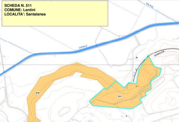
Santalanea archaeological area
Inhabited of the Byzantine Age
Rock inhabited area that occupies the most upstream part of the quarry; cave - church with traces of the XNUMXth-XNUMXth century iconostasis. and remains of pictorial decoration; necropolis with bell-shaped pit tombs, on the terrace to the west of the quarry, around the farm
Area of archaeological interest, art. 142 letter m) Legislative Decree 42/04
(Text source: survey form no.511 Landscape Plan of the Province of Syracuse - Archaeological Heritage)
Archaeological Heritage Sheets Landscape Plan of Syracuse
PRESS: Well cataloged but partially geolocated. We invite you to provide your contribution by providing us with useful information that will allow us to geo-locate the listed asset. See also "Cultural Heritage to be Geolocated"
Card insertion: Ignazio Caloggero
Information contributions: Ignazio Caloggero Web,
Note: The populating of the files of the Heritage database proceeds in incremental phases: cataloging, georeferencing, insertion of information and images. The cultural property in question has been cataloged, georeferenced and the first information entered. In order to enrich the information content, further contributions are welcome, if you wish you can contribute through our area "Your Contributions"
