

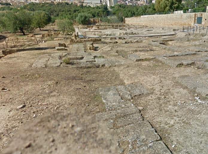
Upper Agora
West of the car park of the Museum of San Nicola, near the Bouleuterion. It is the Agora of the Greek era, the square where the market was held and the citizens gathered in assembly
"Sicily on the Net" web area connected: Archaeological Area of Agrigento (Valley of the Temples) (1997)

Area recognized by UNESCO (Source Unesco.org)
Download map in pdf: IT-831-item28
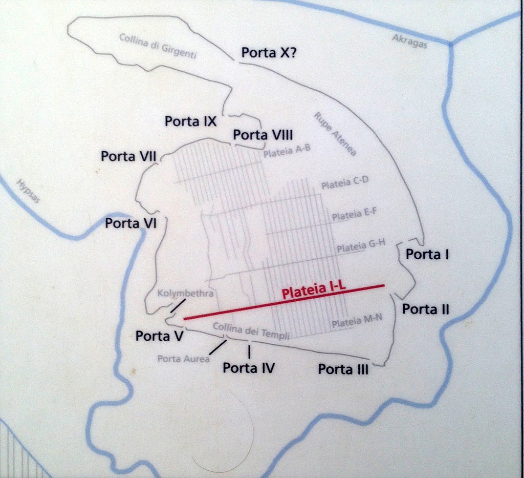
The gates of Agrigento (Source Wikipedia)
Card insertion: Ignazio Caloggero
Information contributions: Ignazio Caloggero Web
Photo: web
Note: The populating of the files of the Heritage database proceeds in incremental phases: cataloging, georeferencing, insertion of information and images. The cultural property in question has been cataloged, georeferenced and the first information entered. In order to enrich the information content, further contributions are welcome, if you wish you can contribute through our area "Your Contributions"
