

Ancient Walks and Historical Itineraries of Sicily: VII. Catania - Enna - Termini Imerese
Phase B: Rev 1.0 (edited by Ignazio Caloggero)
Interactive map updated in real time. For a global view of all the historical itineraries of Sicily, for the presentation of the project, the "zoomable" historical maps taken as reference and the relative methodological notes, please refer to the project page: Ancient paths and historical itineraries of Sicily. For a view of all the routes in one web page, see: Ancient Paths and Historical Itineraries of Sicily: All the routes live.
The map shows the main "stations" and the archaeological sites encountered along the way. Under the map further details and technical notes.
Description
From the Tabula Peutingeriana and from the Itinerarium Antonini the following starting route is obtained:
- Catina (Catania)
- Aethna (Paterno)
- Centuripa – Centurippa (Centuripe)
- Agurio (Agira)
- Enna
- Thermis (Termini Imerese)
Summary of the path
- Section VIIA (Catania – Agira)
- Section VIIB (Agira – Sulfara)
- Possible Variant VIIB1 (Agira – Nissoria – Sulfara)
- Possible VIIB2 Variant (Agira – Assoro – Sulfara)
- Section VIIC (Sulfara – Enna)
- Section VIID (Enna – Villapriolo)
- Possible Variant VIID1 (Enna – Villarosa – Villapriolo)
- Possible Variant VIID2 (Enna – Calascibetta- Villapriolo)
- Section VIIE (Villapriolo – Alimena)
- Section VIIF (Alimena – Caltavuturo)
- Possible Variant VIIF1 Alimena – Polizzi – Caltavuturro)
- Possible Variant VIIF2 (Alimena – Recattiva – Caltavuturro)
- Section VIIG (Caltavuturo – Himera)
Below is the detailed description
Section VIIA (Catania – Agira)
- Catania (Catina) (C13) (C14) (6) (C4) (3.480) (CAMS)
- VIIA.1: Misterbianco (CAMS) (C27) (C26)
- VIIA.2: Contrada Erbe Bianche (CAMS)
- VIIA.3: Valcurrent (C7) (C26) (CAMS)
- VIIA.4: Contrada Grammena (CAMS)
- VIIA.5: Paternò (Aethna – Ibla) (C5) (C7) (C13) (C14) (6) (C4) (C26) (C27) (C28) (3.480) (13.328) (CAMS)
- VIIA.6: Passo d'Ipsi (C26)
- VIIA.7: Pietralunga Roman Bridge (3.480) (CAMS)
- VIIA.8: Roman Bridge of Centuripe (Contrada Paportello) (3.480) (CAMS)
- VIIA.9: Poggio Cipollazzo (C26)
- VIIA.10: Centuripe (C7) (C13) (C14) (6) (C4) (C7) (C26) (C27) (C28) (3.480) (13.328) (CAMS)
- VIIA.11: Contrada Bagni (CAMS) (C26)
- VIIA.12: Monte San Giorgio (CAMS)
- VIIA.13: Rapes (C26) (CAMS)
- VIIA.14: Bells (C26)
- Agira (Agurio) (C12)(C13) (C14) (6) (8) (3.480) (C28) (CAMS) (13.328) (6) (C2) (C4) (C5) (C7) (C27)
Possible Variant VIIB1 (Agira – Nissoria – Sulfara)
-
- VIIB1.1: Nissoria (17.163) (c27) (c26)
- VIIB1.2: Contrada Perciata (CAMS)
- VIIB1.3: Leonforte (*) (C4) (3.480) (C5) (C2) (C7) (C26) (C27)
- VIIB1.4: Washed face (C26)
- Sulphara (C26)
Possible VIIB2 variant (Agira – Assoro – Sulfara)
-
- VIIB2.1: St. George (CAMS) (C26)
- VIIB2.2: Murra Plan (CAMS)
- VIIB2.3: Assoro (*) (3.480) (CAMS) (C28)
- VIIB2.4: Contrada Piano Corte (CAMS)
- Sulphara (C26)
Section VIIC (Sulfara – Enna) (see note)
- VIIC.1: Canalotto (CAMS) (C26)
- VIIC.2: Contrada Sampieri (CAMS)
- VIIC.3: Contrada Piana Municipality (C26)
- VIIC.4: Caledrara (Calderari) (C26)
- VIIC.5: Contrada Vilardi (C26)
- Enna (Castrogiovanni) (C2) (C5) (C7) (C12) (C13) (C14) (C27) (C28) (C29) (6) (3.480) (CAMS) (13.328)
Section VIID (Enna – Villapriolo)
Possible Variant VIID1 (Enna – Villarosa – Villapriolo)
- VIID1.1: St. Julian's (CAMS) (C26)
- VIID1.2: Villarosa (3.480)
- VIID1.3: Monte Giulfo (CAMS) (C26)
- Villapriolo (3.480) (C26) (C27)
Possible Variant VIID2 (Enna – Calascibetta- Villapriolo)
- VIID2.1: Calascibetta (C2) (C5) (C7 ) (C26) (C27)
- VIID2.2: Good rest (CMAS)
- Villapriolo (3.480) (C26) (C27)
Section VIIE (Villapriolo – Alimena)
- VIIE.1: Contrada Serra del Vento (C26) (CAMS)
- VIIE.2: Right-handed – Areddula (C26) (CAMS)
- Feed (3.480) (C26) (C5) (C2) (C7) (C27)
Section VIIF (Alimena – Caltavuturo)
Possible Variant VIIF1 Alimena – Polizzi – Caltavuturro)
- VIIF.1,1: Bompietro (3.480) (C27)
- VIIF.1,2: Roman Bridge (CAMS)
- VIIF.1,3: Petralia Sottana (3.480) (C5) (C27)
- VIIF.1.4: Calcarelli (C26) (CAMS)
- VIIF.1.5: Contrada Campo (C26)
- VIIF.1.6: Polizzi (3.480) (C2) (C27)
- VIIF.1.7: Balate Pass (C26)
- VIIF.1.8 : Cozzo Vurrania (CAMS) (C26)
- Caltavuturo (3.480) (CAMS) (C5) (C2) (C7) (C27)
Possible Variant VIIF2 (Alimena – Recattiva – Caltavuturro)
- VIIF2.1: Resuttano Castle (nearby) (C26)
- VIIF2.2: Middle Monk (CAMS)
- VIIF2.3: Cozzo Ciaciallo (CAMS)
- VIIF2.4: Sanctuary of Cuti (CAMS)
- VIIF2.5: Scorsone Garden (CAMS)
- VIIF2.6: Reactive (CAMS)
- VIIF2.7: Monte Catuso (CAMS)
- Caltavuturo (3.480) (CAMS) (C5) (C2) (C7) (C27)
- Section VIIG (Caltavuturo – Himera)
- VIIG.1: Cerda (3.480) (C27) (C26)
- VIIG.2: Locality Vallatrice (CAMS) (C26)
- VIIG.3: Contrada Agliastro (CAMS) (C26)
- VIIG.4: Contrada Tornuccia (CAMS) (C26)
- VIIG.5: Borgo La Signora – Contrada Villaurea (CAMS) (C26) (C27 not far away, the archaeological site “La Signora” is indicated on the right of the road)
- VIIG.6: Cozzo Rocca del Drago (CAMS) (C26)
- Termini Imerese (Himera) (3.480)
Insights
Section VIIA (Catania – Agira)
- Section VIIB (Agira – Sulfara)
- Possible Variant VIIB1
- Possible Variant VIIB1
Biagio Pace in (4.480) writes: "we cannot decide if the road from Agirio climbed to Assoro to pass to Enna or if it was a matter of a diverticulum of the consular road that branched off from the approximate site of Leonforte"
So I preferred to indicate two possible variants, which take into account, among other things, the archaeological sites encountered, which will be better studied in the future.
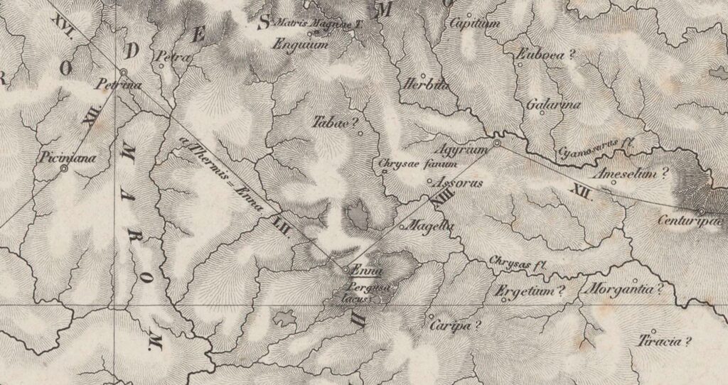
Da C28: Siciliae Antiquae Tabula (1834)
Section VIIC (Sulfara – Enna)


To study better, the path in blue, bearing in mind that many maps indicate a path Agira – Calscibetta (C2), (C5), (C7), (C26), (C27)
Section VIID (Enna – Villapriolo)

For the same reasons as the previous point. To be studied better, the path in blue.
Bibliography and Reference Cartography.
(1) (3) (6) (13) (15) (17) (22) (48) (99) (CAMS) (C1) (C2) (C4) (C5)(C7) (C12) (C13 ) (C14) (C16) (C18) (C26) (C27) (C28) (C29) (C30)
- [1] Giovanni Uggeri: The formation of the Roman road system in Sicily
- [3] Biagio Pace: Art and Civilization of Ancient Sicily Vol. 1 pag. 453-488
- [6] Description of Sicily extracted from an Arabic book (re. Anas. 1764) by Al-Idrisi (Author), Nuccio Cannarella (Editor), Domenico Macrì (Translator) Published in 2019
- [13]: G. Uggeri: Itineraries and roads, routes, ports and ports of call of late ancient Sicilyin Proceedings IX Ancient Sicily Congress (Palermo 1997), "Kokalos" 43-44 (1997-1998), Rome 2000, pp. 299-364.
- [15]: G. Uggeri: The Roman road system in Sicily with particular regard to the third and fourth centuries. In Kokalos XXVIII-XXIX 1982-1983
- [17]: G. Uggeri: Sicily in the "Tabula Peutingeriana" - Editore Loffredo - Naples 1968
- [22] Adolfo Holm History of Sicily Antiquity Vol. III Chap IV
- [48] Salvatore Scarlata and Liborio Bellone: A hypothesis of a path in ancient times between Catania and Enna in Proceedings of the Conference of Studies: Itineraries and communications in Sicily between Late Antiquity and the Middle Ages - Caltanissetta on 16 May 2004
- [99] Ignazio Caloggero: The Project Ancient Paths and Historical Itineraries of Sicily
- CAMS: Multimedia Archaeological Map of Sicily - Link: https://www.lasiciliainrete.it/archivio-patrimonio-archeologico-di-sicilia/
- C1: Road and rail communications - 1943 Author: Great Britain. Army. Royal Engineers. Field Survey Company, 514th.
- C2: Regni & Insvlae Siciliae Tabula geographica ex Archetypo gradiori in hoc compendium redacta - 1747 author: Homann, Johann Baptist
- C4: Nova et accurate Siciliae Regionum, Urbium, Castellorum, Pagorum Montium, Sylvarum, Planitierum, Viarum Situum ac Singularium quorumque locorum et rerum ad Geographiam Partinentium Descriptio Universalis - 1721 author Schmettau, Samuel von
- C5: Carte de l'Isle et Royaume de Sicile Autor: Delisle, Guillaume, 1675-1726
- C7: Sicily. Publisher: Robert Laurie & James Whittle (1799) (always referable to the Schmettau paper)
- C12: Siciliae Antiquae quae et Sicania et Trinacria dicta tabula geographic. Publisher: L'Isle, Guillaume de, 1675-1726
- C13: [4] Tabula Peutingeriana (medieval map of the Roman world written by a monk of Colmar XIII century
- C14: [5] Itinerarium Antonini
- C16: Guidelines of the Regional Territorial Landscape Plan - Historic road network
- C18: Sicily Trazzerale Network (1929). Published in the Journal of the Land Registry and Tax Services in 1941
- C26: Europe in the XNUMXth century. century (with the Third Military Survey)
- C27: Comparative Map of Modern Sicily (1859)
- C28: Siciliae Antiquae Tabula (1834) (Sicily Tabulae Peutingerianae)
- C29: La Sicile Pour l'Histoire Romaine (1740)
- C30: Cartography of the Landscape Plans of the Sicily Region which can be consulted online (for the trazzere and historical routes)
For the bibliography and general cartography see the page: Methodological Notes and Bibliography
Technical and methodological note
The Multimedia Map of the Ancient Historical Paths is created in sub-phases (not necessarily sequential):
- Phase A (Basic Path): in the first sub-phase the paths are identified in the form of a first draft divided into segments and sections (taking into account the bibliography, the historical maps analyzed and the Multimedia Archaeological Map of Sicily (CAMS) and only partially the paths on the ground). The basic route is the starting point proposed to the scientific community, preparatory to the subsequent phase of detailed analysis of the individual segments that make up the entire identified path
- Phase B (Advanced Path): in the second phase, an incremental refinement process will begin by adapting, as faithfully as possible, the individual components that make up the route to the historical routes and to the tracks on the ground and where the ancient traces have been lost, adapt them to the current routes that are closest to the ancient paths (keeping track of the historical paths, where identified). The incremental refinement process will also take into account historical roads, natural roads and further studies and contributions from the scientific community and scholars in the sector.
- Phase C (Subdivision of the paths): When fully operational, the project provides for the drafting of two paths that may diverge in some points: a path as faithful as possible to the ancient path regardless of its current practicability and another that could form the basis for proposing itineraries that take into account the actual practicability and the possibility of enjoying the historical, artistic and naturalistic beauties close to the historical route.
Note: In cases where the ancient route is no longer identifiable or has been completely replaced by high-speed roads, or obstructed by industrial plants or other types of impediment, an attempt has been made to identify a stretch that in some way is closest to the characteristics of a naturalistic path or in any case a substitute for the fast-flowing path. In some cases, moreover, in case of doubt between two possible routes, the route that allows you to pass in the immediate vicinity of landscapes or cultural heritage considered interesting from a tourist-cultural point of view has been taken into consideration.
